
A class activation mapping guided adversarial training method for land-use classification and object detection
Published in IEEE International Geoscience and Remote Sensing Symposium, 2019
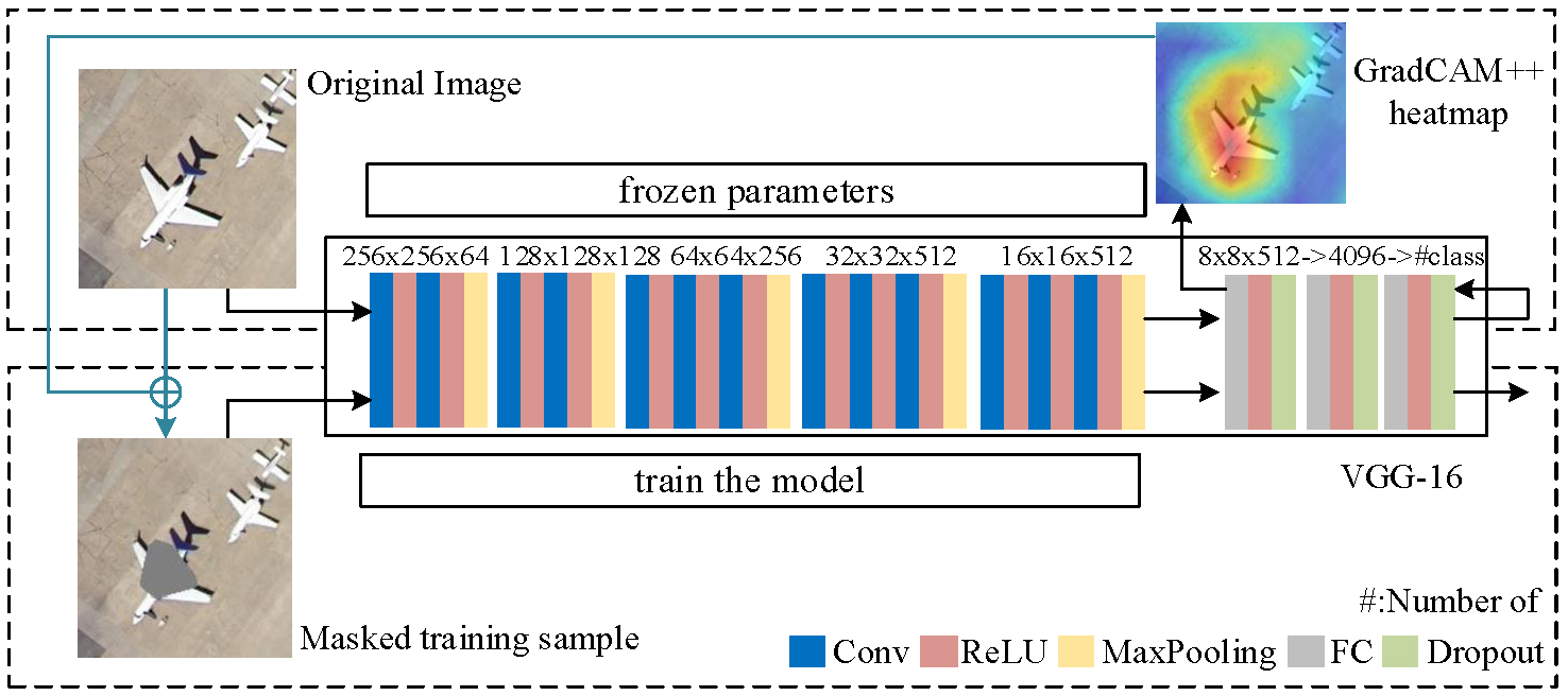
In this paper, we demonstrate an interpretable training method, namely class activation mapping guided adversarial training (CAMAT), for two typical remote sensing tasks, land-use classification and object detection. We first generate class activation maps of the current batch training samples. Class activation map is a kind of class-specific saliency map that quantifies the contributions of a particular region in the image to the CNN prediction result. Then, the most important regions are occluded in the training stage, and we use the masked images along with the clean images as the inputs for network training. Following this paradigm, the most discriminative areas for network learning and decision making are purposefully disturbed in the training phase, thus the trained model could have better performance in robustness and generalization.
Recommended citation:
R. Yang, X. Xu, Z.-Z. Xu, C.-J. Ding and F.-L. Pu, “A class activation mapping guided adversarial training method for land-use classification and object detection”, in Proc. IEEE Int. Geosci. Remote Sens. Symp.(IGARSS), August. 2019.